map16 Gully Cleansing and Gully Maintenance

Gully Mapping And Inspections Made Easy

By Gully Maintenance, Map16, Mobile Collection, Solutions, Web Dashboard

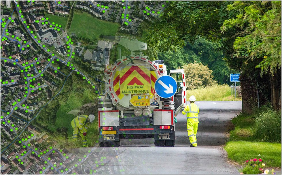
Map16 are changing the way gully inspection and mapping is being carried out across the UK highways. Years of development went into fine-tuning the solution, which is now available in the market place.

The map16 system is now managing over 221,100 assets and over 966,000 inspection records daily, all of this with no interaction from operational staff at any time throughout the year.

Our innovative solutions set us apart from the competition and give our clients a cost effective approach to collecting county wide inspection data on any drainage assets.

What do we do differently? Keep reading to find out.

One Time Setup

map16 does the hard work for you, year in and year out. At the start of every contract map16 provides everything, fully setup iPads and integrated web dashboards, specifically designed to fit our clients need. Yearly KPI’s are integrated, and all historic data is transferred from any other sources.

OS MasterMap As Standard

To provide an industry standard of asset mapping and management, it is a necessity to capture accurate data. By becoming an Ordnance Survey Partner, map16 provides the highest detailed mapping as a standard. This is used in both our mobile collection devices and our web dashboard. Stay tuned on further news updates on map16 as OS Partner. Linkedin

Find Out More

map16 ordnance survey partner


No More Work Packages.

end-of-work-packages

Crews and operational teams no longer have to download new areas to work from. They can work live on map16 tablets, with all asset data instantly available. When in areas of no signal, they are able to move seamlessly to an offline map, covering county wide areas. Data is then transferred when signal is regained. As part of the initial setup, tablets come preloaded with offline maps. This simple change in workflow increases operational efficiency every step of the way.

Find Out More

Custom Views

All views are dictated by our clients. Anything from borough by borough to visualised by cleansing frequency. This ensures teams on the ground only see gullies they have to clean. Along with this, every iPad is linked so inspections from other crews are visible to everyone. No one wants inspections to be done twice, when not needed.

Automated Parked Car Revisit Maps

Automated parked car revisits


map16 provides custom revisit maps that are automatically populated by live data collected in the field. We operate a traffic light system, depending on revisits required. As an example, parked cars have to be visited 3 times. When they are located, it will appear on the map as RED, when a second inspection is done it will turn ORANGE, once the final inspection is complete, it will turn GREEN. If it gets cleaned on the second visit it will also turn green. This enables teams on the ground to see exactly what needs to be done. The web dashboard also enables operational staff to export all outstanding park car inspections with a click of a button.

Find Out More

Flood Risk Analysis Provided As Standard

map16 flood risk analysis

Integrated into every map16 gully system is live flood risk analysis. Which is based on key flood risk layers available. These include surface water flooding zones, known flooding areas, anonymised insurance claims, Lidar elevation models, historic silt levels and any other dataset available. Our system allows our clients to make accurate decisions on cleansing optimisations throughout the year.
Drive efficiencies by taking an innovative approach. Follow map16 on Linkedin to find out more in the next few weeks.

Find Out More

Interactive Programme Of Works

map16 - Interactive programme of works

When it comes to routine gully maintenance, clients want to know 3 things.

  1. Have you been there.
  2. When were you there last
  3. When are you going to be there next.

Why not have the answers to all these questions in one system. We provided live inspection data, access to all historic records, and now an interactive forward facing programme. We can take any MS Excel or Project programme and import it into the system. Users can then update progress and download all changes, live directly from the system.

Follow map16 on Linkedin to read a more detailed article coming in the next few weeks.

Unlimited User Access To Our Web Dashboard

map16 - Web Dashboard

It is clear that giving more people access to live data is key. As a standard, map16 provide unlimited user access to everyone that requires it. We have found that if more people have access to the data, emails, phone calls and queries will decline.
Why ask the question when you can answer it yourself, quicker than ever before.

Find Out More

Follow map16 on Linkedin to see detailed articles on each aspect over the next few weeks

If This Could Benefit Your Business – Get In Touch An Request A Demo

0800 772 396

take a standardised approach

A Standardised Approach To Asset Management

By Map16, Mobile Collection, Solutions, Web Dashboard

Our system provides 4 core aspects to make a standardised solution.

Why not standardise the way your organisation collects and manages all their assets, inspections and separate workstreams.

1 – Mobile Collection

map16 provides a mobile data solution for any business need. Map new features, collect new inspection records for all highway assets. Every aspect is streamlined to increase operational efficiency, and overall reducing the cost. Using innovative new technique to remove the need for work package creation and automation of asset revisit maps. Stay tuned over the next few weeks to read more detailed articles.

map16 - Mobile Solution


By creating a standard user interface, operatives working on drainage or safety barriers, will be familiar, and no extra training will be required.

2 – Inspection Dashboards

No matter what type of inspection data is required, we create a standardised approach to reporting. The focus of our inspection dashboard is to give clients the data they need at their fingertips. Export any data within two clicks.


Standardised inspection dashboards

A well crafted dashboard, should automatically reduce the work carried out behind the scenes in any business.

  • Overview of progress across the highway network
  • Clear KPI reports with exportable data
  • Crew reports showing progress and productivity
  • Defect reports or any other data available.
  • Road by road reports

All reports are designed for all data to be exported in any format required, including CSV, shapefile and geodatabase.

Find out More

3 – Asset Dashboards

In any good asset management system there is the ability to interrogate core asset data. Here at map16, we provide a standardised approach to asset data analysis from traffic signs to highway gullies. Customised to meet the need of every client.

Standardised asset dashboards

All reports are designed to be exported. No need to query datasets, everything has been created for you.


  • Overview of key asset figures (e.g. size, condition and number of species)
  • Breakdown of asset data based on geographic area. (e.g. district, parish, borough and ward)
  • Detailed breakdown of key attributes.(e.g. tree maturity, illumination type and cleanse frequency)
  • Defect reports or any other data available.
  • Road by road reports

Our bespoke dashboards create a standardised view for every asset.

4 – MapView

The final and maybe the most important aspect is the map view. This is the most used part of our system, as it integrates every aspect;

  • Current inspection data – Live from mobile collection devices
  • Historic inspection data – All data ever collected on the network
  • Asset data – No limit on asset numbers or types, point, polygon or polyline.
  • Road networks
  • Areas – Districts – Parish – Borough – Ward


Our standardised map views have the same tools through every system, asset or work stream.

Allows the workforce to seamlessly move between any dataset with no worry of additional training or getting lost in a complex user interface

Get In Touch And Lets Us Show You – 0800 772 396


map16 Asset Management ltd

One System Every Asset

By Map16, Mobile Collection, Web Dashboard

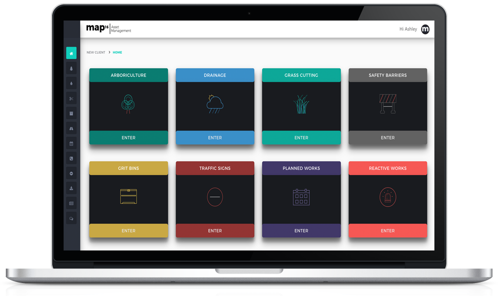
Have you ever wondered what it would be like to have all your highway assets in a modern, easy to use, standardised system? Look no further, map16 can provide exactly that.

Why not take a standardised approach to asset and inspection data across all highway datasets. Here at map16 we have provided that exact solution, crafted from years of industry knowledge and understanding of what current systems are capable of.

Why not standardise how your workforce view, monitor and export all highway data. Whether its drainage, grass cutting, grit bins or any other, we have a solution to meet your every requirement. Our light weight framework allows map16 to seamlessly design bespoke systems for all our clients.


map16 - Web Dashboard

Gully Maintenance

map16 - Planned And Reactive Works - Dashboard

Planned & Reactive Works

map16 - Arboriculture - Dashboard

Arboriculture

map16 - Grit Bin Maintenance - Dashboard

Grit Bin Maintenance

map16 - Grass Cutting - Dashboard

Grass Cutting

map16 - Traffic Signs - Dashboard

Traffic Signs


map16’s complete solution creates an industry standard of asset and inspection data collection, with custom fields and drop down options meeting all requirements. Work live or offline, without any work packages from the office. Not only are we trying to standardise how data is viewed across all work streams, but also change the way data is collected. See how map16 can save you time and money by working in a modern way. Check out our future posts to see how.

One system every asset. Create a standardised approach to mobile data collection and web dashboard reporting.

Get In Touch – 0800 772 396