map16: Unlocking Data Insights Workshop 📈

By Inside map16...

At the start of the February, Alex and Josh kicked off the map16: Unlocking Data Insights Workshop 📈

Traveling country-wide to visit our clients, the workshop will provide further training, knowledge and insight into how to get the best out of the map16 system. The sessions have allowed us to work even closer with clients and means we keep building software that makes a difference to their business.

We’re looking forward to helping as many of you as possible maximise the potential of your platforms 💻

Essex Installation

By Gully Sensors


A successful mission installing gully sensors and a flood monitoring camera with Ringway Jacobs and Essex Highways last week, making the highway safer during this incredibly wet weather. A great way to start the year, the first of many exciting projects to come.

London Borough of Redbridge Gully Sensors

By Gully Sensors


map16 Asset Management have started working with The London Borough of Redbridge to supply them with their Smart IoT Gully Sensor system.

map16 have created an IoT gully sensor that combines IoT with innovative and resilient sensor technology that can be used to predict and monitor the impacts of moderate to severe weather events. Using 4G technology to communicate, gully sensors have the ability to work together to provide users with a live feed of key gully levels, lid opening and grid obstructions such as parked cars and leaf cover. The data then feeds into the map16 SaaS IoT platform and creates predictive analytics, risk forecasting and weather event modelling, complied into a fully integrated data-centric dashboard.

The London Borough of Redbridge has identified flooding hotspots within the area and will now use the technology to detect early signs of flooding and start predicting a gully’s behaviour by linking the data to predicted rainfall within the area.

Dhiresh Bhatt, Head of Highways at the London Borough of Redbridge said “Parts of the London Borough of Redbridge alongside many other boroughs were flooded in July 2021, which prompted us to investigate how technology can help us ensure our infrastructure is working as it should. We want to install gully sensors to better understand our infrastructure in our flooding hotspots and the effect of our cyclical cleaning regime has with a view to adjusting that programme if required and becoming more proactive in our asset maintenance.”


August Case Study – Charlton Environmental

By Invasive Weeds


“ Using the map16 system has enabled us to achieve higher work outputs due to the time saved routing/plotting sites. The efficiencies for the teams on site are further enhanced by the real-time data being fed back into the office and direct to clients, which can be exported and analysed far more efficiently and comprehensively than our previous system. The support from the team at map16 and their understanding of the requirement have been unparalleled. ”  Stephen John | Charlton Environmental

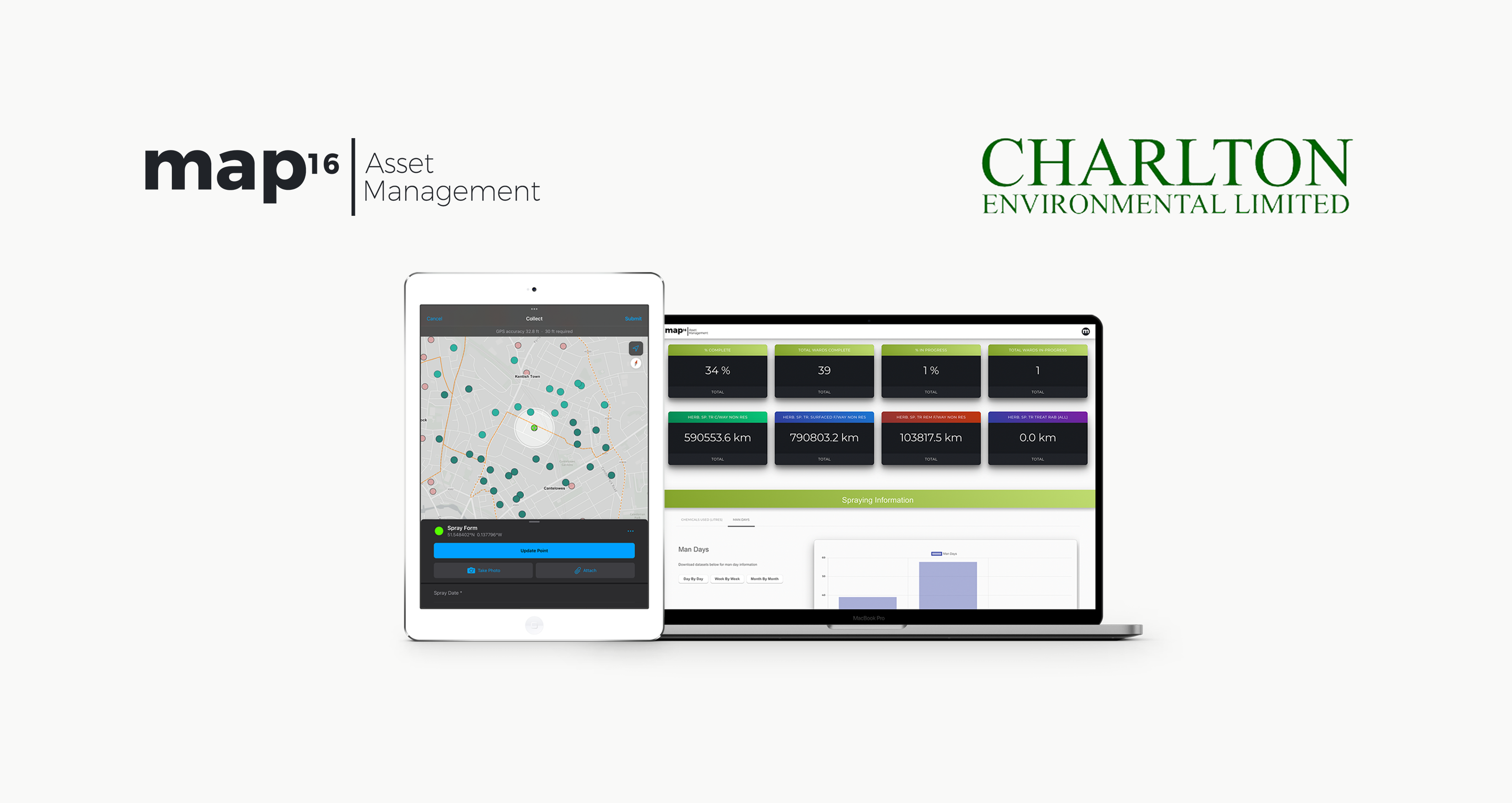
Responsible for controlling and treating invasive weeds around public areas within Hampshire and London Boroughs, Charlton Environmental needed an efficient, innovative way to map required works on street pavements, kerbs, central reservations, subways, shopping centres and parks, and collect inspection and treatment records.
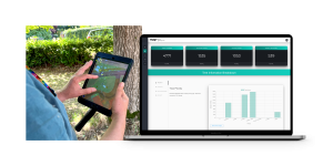
 

The Approach 

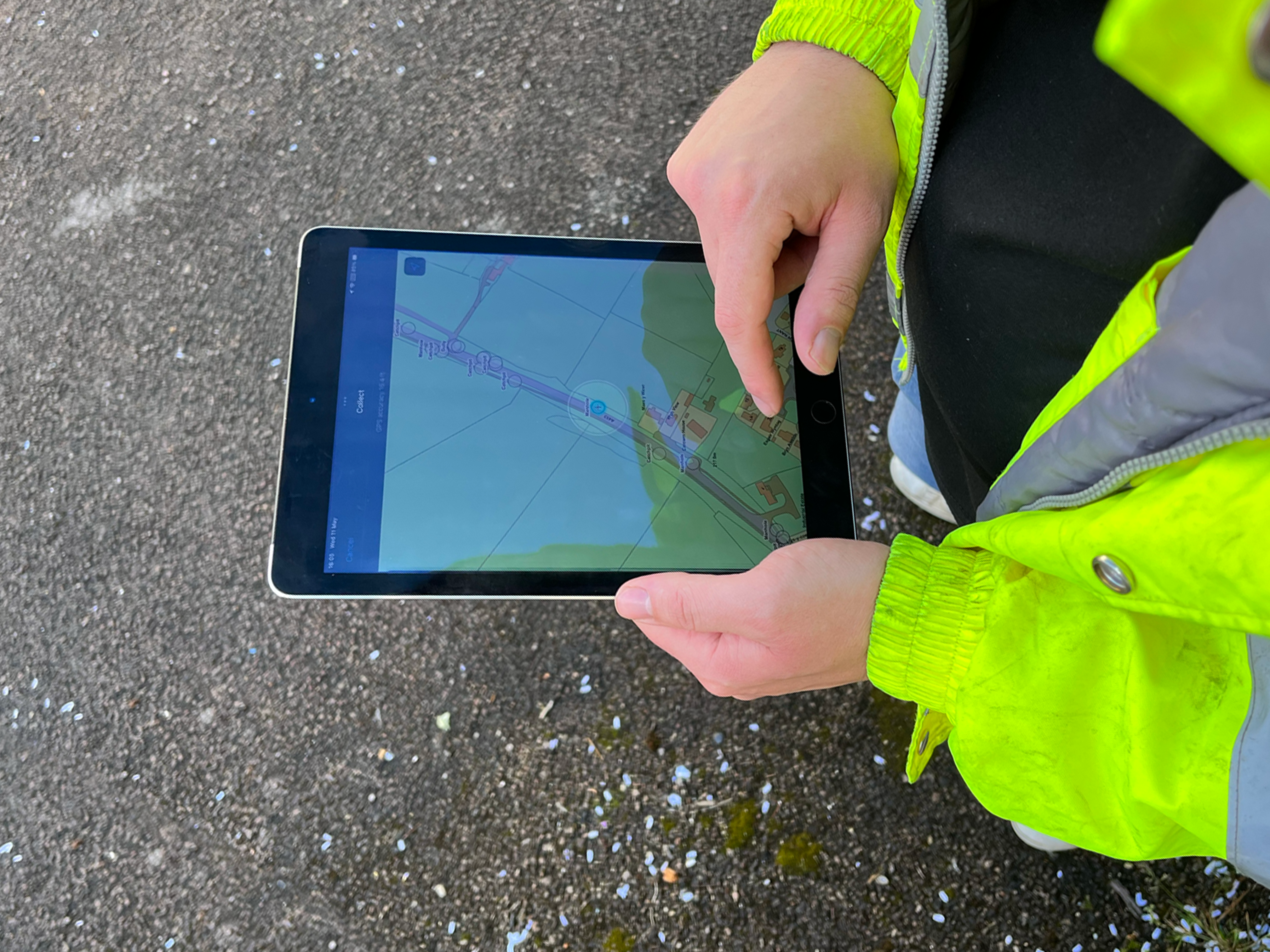
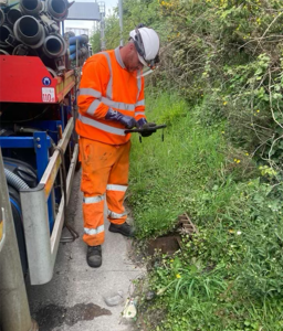
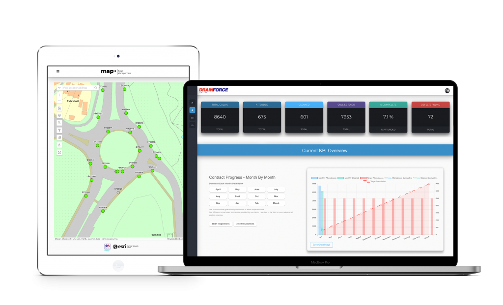
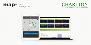
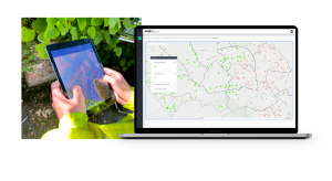
map16 designed a system to do just this. Crews on the ground completing weed sprays can send maintenance data to the system live from the site, updating a bespoke designed service dashboard displaying data such as the total amounts of chemicals used, and the total number of sites completed. Users can navigate a map view dashboard to view specific spraying sites and spraying records, with detailed report information for specific sites available at the click of a button.

The Benefits

With the completely electronic data collection system, Charlton Environmental can ensure their data is up to date and accurate, ensuring maximum safety for the public and increasing their workforce productivity and efficiency.

July Case Study – University of Bristol

By Tree Management


map16 has become intrinsic to our tree management system, allowing our trees to be mapped and for our inspections to be carried out and logged in real time on an iPad. The completed inspection and subsequent completed works are colour coded on the map to give a clear visual picture of working progress. The process is slick and efficient and allows for spreadsheets to be downloaded back at the office to compile work schedules, as well as allowing historic data of previous inspections and works to be compiled. ”  Kevin Stuckey | University of Bristol


The Approach 

Using map16 tablets, the University of Bristol identified around 5,000 trees within and around their grounds and the surrounding area, and logged these into the map16 system. This allows surveyors to monitor these trees as regularly as necessary, and accurately log the findings directly into a fully integrated map view dashboard, live from the field. Inspection information and specifications such as the tree type, height, maturity, stem condition and basal structure are all displayed in an easy to navigate dashboard, allowing effortless observation and comparison of every tree.

The Benefits

Regular surveying of trees, especially within built up urban areas is crucial for ensuring public and traffic safety, as broken and fallen trees can be a dangerous hazard if not dealt with. By being increasingly aware of their trees condition, the University of Bristol can be one step ahead of their maintenance and management programs, greatly increasing workforce efficiencies. Live and historic data can be downloaded directly into the back-office systems.

May Case Study – Welsh Government

By Gully Maintenance


May’s case study comes from a project we’ve recently delved into with the Welsh Government, working with Drainforce to manage the Welsh Government’s drainage assets using our mobile data collection capabilities and bespoke asset dashboards.

Gully Maintenance Case Study

Client

Welsh Government & Drainforce

Project

Drainage Asset Management of Welsh Trunk Roads

Solution

map16 Asset Management platform for asset inspections and inventory updates


The Story


The Welsh Government’s trunk road network is currently split into three sections: SWTRA, MWTRA & NWTRA. The Welsh strategic road network covers 1,510 kilometres of trunk road, including six road tunnels and 178 kilometres of motorway. The Welsh Government engaged with map16 Asset Management to work together to develop a system to collect and manage drainage assets across their strategic road network. Our unique skillset allows us to assist the client with managing their asset inventories and updating asset conditions, all housed within a centralised platform. This has given the Welsh Government a deeper understanding of their assets, ultimately leading to a better service to the public.


"map16 was chosen as the main asset management and data collection platform for the 
Welsh Government’s drainage assets on their strategic trunk road network due to its ease 
of use and seamless integration into our Integrated Roads Information System (IRIS). 
Using map16 the Welsh Government has seen an increase in data accuracy allowing our teams to 
drive cleansing efficiencies across our network. Ultimately giving us the tools to 
manage our network more effectively."

David Denner
Highways Technology Manager, Welsh Government


Bringing life into asset management 

Initially, the problem lay in the Welsh Government having their assets managed by multiple systems depending on which agent was managing that part of the road network.  Some areas were using traditional paper methods of asset management, making it difficult to keep a centralised, up to date and accurate asset inventory, with a clear view of each assets condition. The Welsh Government also needed a platform to store all cleansing history in an easy to access location. 

Providing a complete solution for flood and drainage management

The next challenge came as different asset types throughout the network were being managed across separate systems. These included gully’s, catchpits, manholes, and linear drainage. Having all asset information in one place via an easy-to-use interface would become a real problem solver.

Future proofing the Government’s asset management strategy 

The Welsh Government knew they had to do something to future proof their asset management strategy for years to come. They needed a supplier who was able to design a bespoke solution for their requirements, thus being part of a long-term plan for the strategic road networks.

“We really enjoy working with the map16 team,
 the support they give us is excellent.

David Evans Director, Drainforce

The Approach


The Welsh Government engaged with map16 to design a bespoke system for agents in the area to go out and collect asset data live from the field on their strategic road network. They worked closely with us so we could design a bespoke solution for their requirements. Once designed, the client was able to collect and input asset data into the map16 platform using mobile devices.

Each asset is mapped to its precise location, with information such as:

  • Images
  • Silt Levels
  • Defects
  • Asset Name
  • Asset Location
  • Gully Inspection History

Once the assets had been mapped, the Welsh Government were then able to create and manage their cleansing schedules through their inspection dashboard. Here they were able to break down each part of the network to understand exactly which assets need attending, which assets have been cleaned and any asset defects found.


The Benefits


Increased Efficiency

Collecting data on their assets and being able to manage these all within one platform allowed everyone involved with the strategic road network to become more efficient.

Cost Savings

By increasing efficiency on cleansing schedules, savings were made and costings were reallocated to other areas of the business. Creating an accurate asset inventory will allow further savings when moving to a risk-based cleansing approach. The map16 system provides this solution as standard.

Increased Customer Perception

Ensuring assets on the road network are managed correctly is crucial to the Welsh Government as it directly affects the safety of the public. Being able to manage and monitor their drainage network results in a reduction of the impacts of flooding, and causes less disruption to the general public.

Centralised System

Having asset data collected and managed within one user friendly platform has been a huge benefit to the client. As a result, the data they now have on their assets is accurate and updated live.

Operational Excellence

Having a digital approach to asset management and data collection has improved operations within the road network and allows everyone to work to a higher standard.