A Mapping Interface,
Designed For Users By Users
A mapping interface that gives you access to live inspection data, historic data and detailed reporting tools. Designed for all assets and work stream required.
Query, Filter & Export Key Datasets
All Live & Historic Records
Generate Detailed Reports
Live Mapping Interface
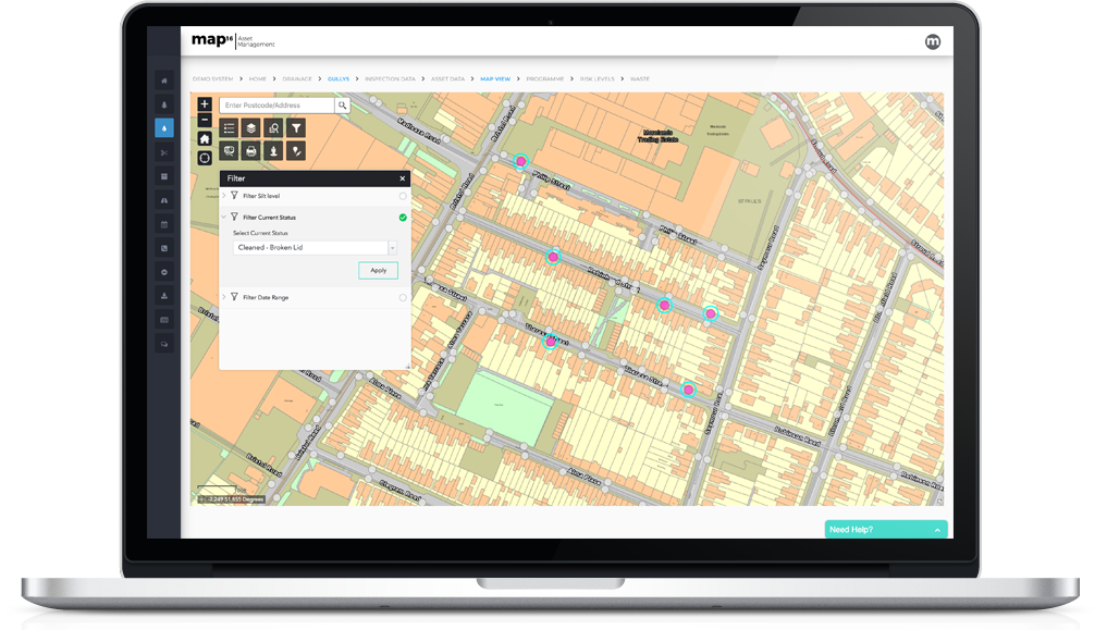
Query & Filter Live Data
Live & Historic Inspections
Create Detailed Reports
Street View Integration
Answer Public Queries In Seconds
With unlimited user access to all our web dashboards, our clients can gain access to live inspections data and historic records. Generate detailed reports to answer queries across your highway network.
All our mapping interfaces are designed around client specific requirements. We provide free of charge, any changes required. We want clients to have the system they actually want.
Live Mapping Interface
Our live mapping interface is connected directly to the mobile devices. It gives your the ability to interrogate any location across your network. Each map view is designed specifically around every clients needs. Add asset and inspection data as well as bespoke layers, including risk areas or key boundary data.
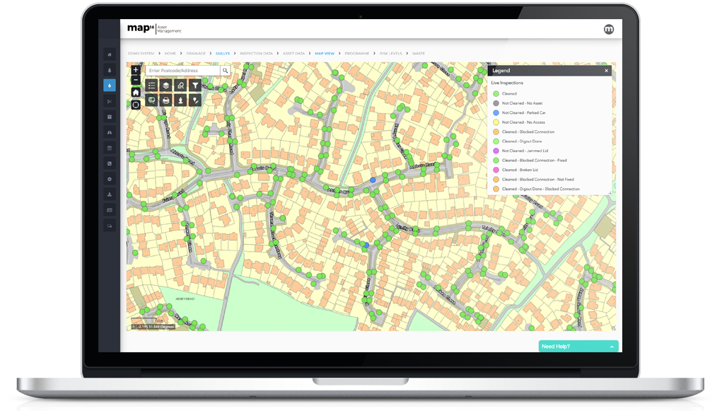
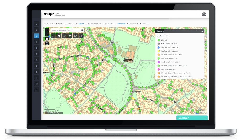
View All Live & Historic Inspections
Use the mapping interface to view key datasets. Monitor live inspection locations and answer public queries on historic records. View the history of every asset across your network. Instantly view inspection or asset images without any hassle. Or, why not go a step further and use a simplified map view to add to any public facing website.
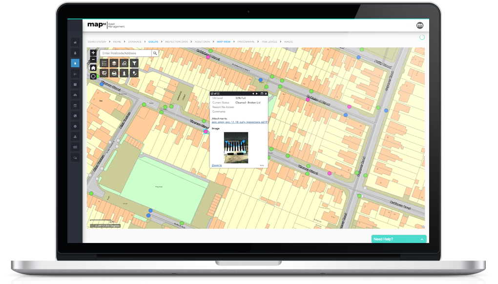
Query, Filter & Export Key Datasets
Navigate the highway network by searching by USRN or road name. Instantly identify the section of highway and what work has been carried out. Query operational efficiencies by crew and date of work. Follow teams progress live on the mapping interface. Filter key information such as condition, defects or silt levels. Export all data to industry standard formats.
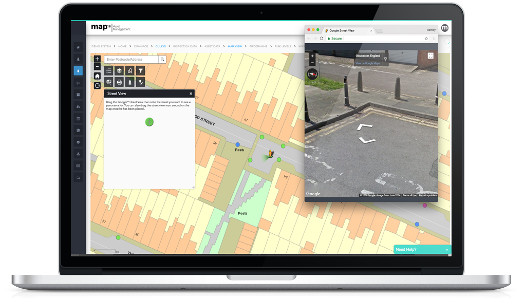
Street View Integration
Get a different perspective on your asset data. View street view anywhere on your network. Navigate the map assessing the quality of data collection or asset placement. Seamlessly move in an out of different views.
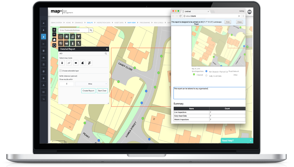
Generate Detailed Reports
Get more out of a mapping interface. Draw around and area of interest to generate a detailed report, comprising any information required. This could include a location map view, asset information, inspection data and any historic records available. Export to CSV, GeoDB or generate a PDF report.