Make operational decisions
based on risk
As standard, map16 provides a risk analysis of your highway assets. Increase efficiency by adopting a risk based approach.
Live Road By Road Risk Updates
Easy Export Of Key Data
Machine Learning Integration
Visual Overview Of Risk Data
Live Risk Updates
Make Decisions Based On Risk
IoT Sensor Integration
Machine Learning
Big Data Analytics
In a risk based maintenance regime, geospatial information can be used to create a targeted and more cost-effective approach. From analysis of simple historic data, flood zoning, population density, slope data, tree fall and insurance claims. All datasets are analysed to produce the most optimal cleansing regimes.
Feed live inspection data into the risk model to give constant risk analysis of the network. Along with this, the risk model can now utilise map16 IoT gully sensor data as well. Driven by machine learning to provide next level risk analysis. Using this approach clients have seen up to 35% reduction in cleansing.
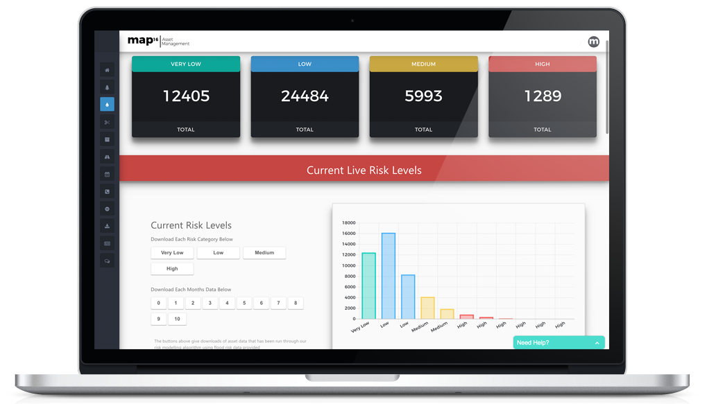
Visual Overview of Risk Data
Visualise your overall risk level of each asset required. View each category or create a bespoke visualisation based on your organisations requirements.
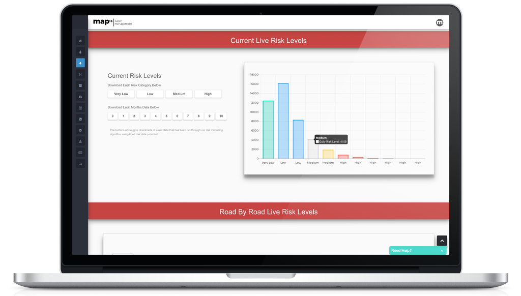
Easy Export of Key Data
Export all data with our 1 button exports or to additional formats including, CSV, Excel, PDF, Shp or GeoDB. Use the data exported to further analyse the risk to your network.
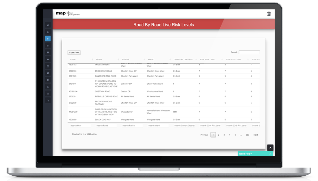
Live Road By Road Risk Updates
Don’t just have a static risk model of your assets. The highway network is a fluid ecosystem that is ever changing. Here at map16, we believe that this is key. That is why our risk models are constantly updating from the data being collected on the ground. View the current risk level on every asset and view the risk change over time.
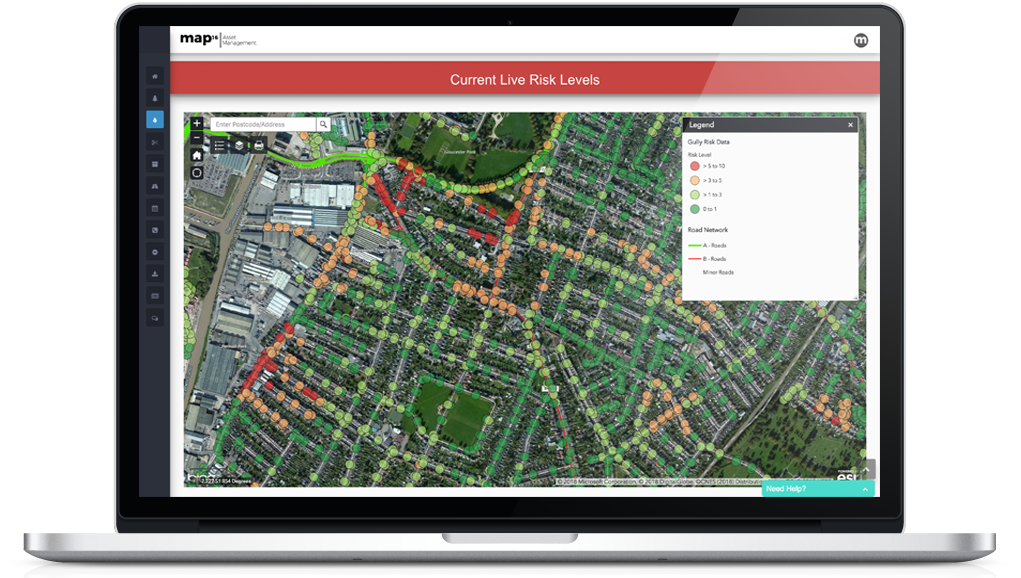
Risk Level Map View
Although visualisation show trends in data, we always prefer to see that data on a mapping interface. Our risk level map view lets organisations view the risk associated with any asset on their networks. Search and view the risk.