Our innovative new way of collecting data allows a one time setup for that reason it enables constant working without the need for creating separate work packages. Set custom map visualisations such as parked car revisits to enable teams to get key information live in the field. Powered by the world leader in GIS technology, Esri.
Key Features
Every key feature has been crafted to increase efficiencies by increasing the simplicity of our client workflows
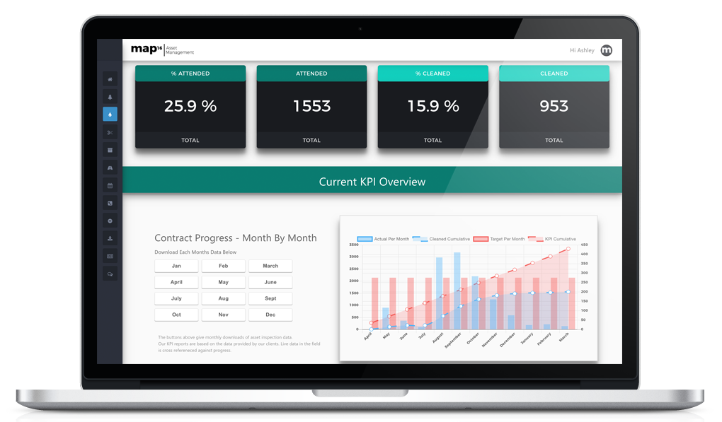
Inspection Dashboard
With unlimited user access to all our web dashboards, our clients can gain access tokey features, live inspection data and historic records. Generate detailed reports to answer queries across your highway network.
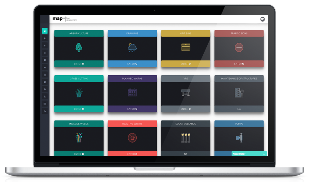
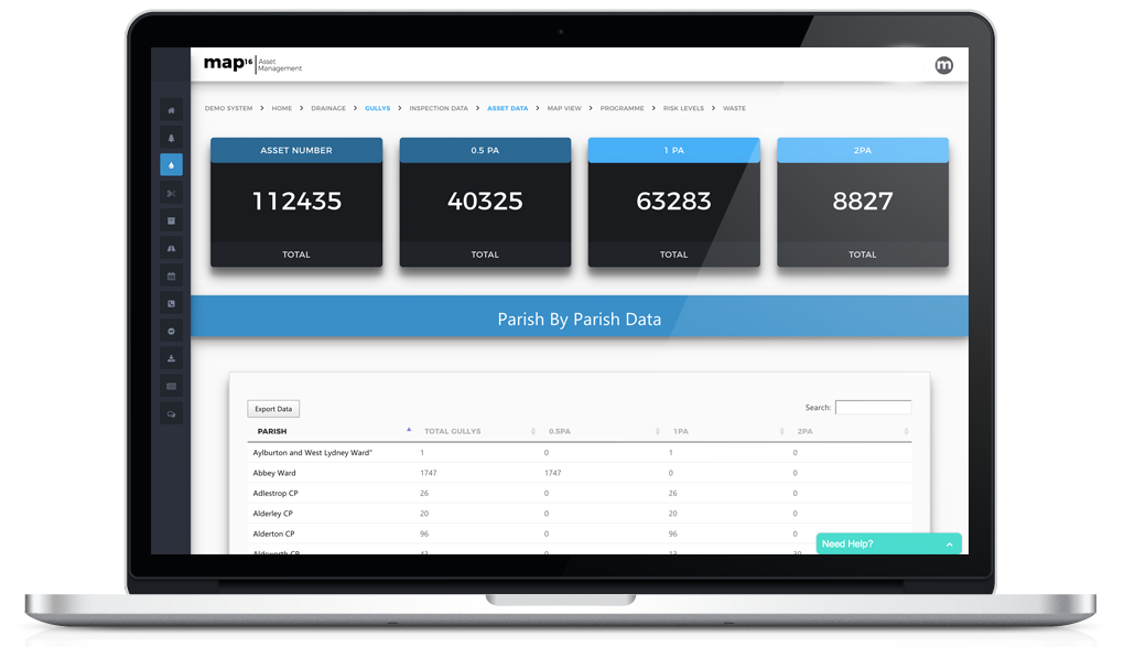
Asset Dashboards
Here at map16, we provide a simplified and easy to use asset management system where clients can visualise and export asset attribute data with a click of a button. Furthermore automatic asset inventory creation keeps track of new and existing assets on the network.
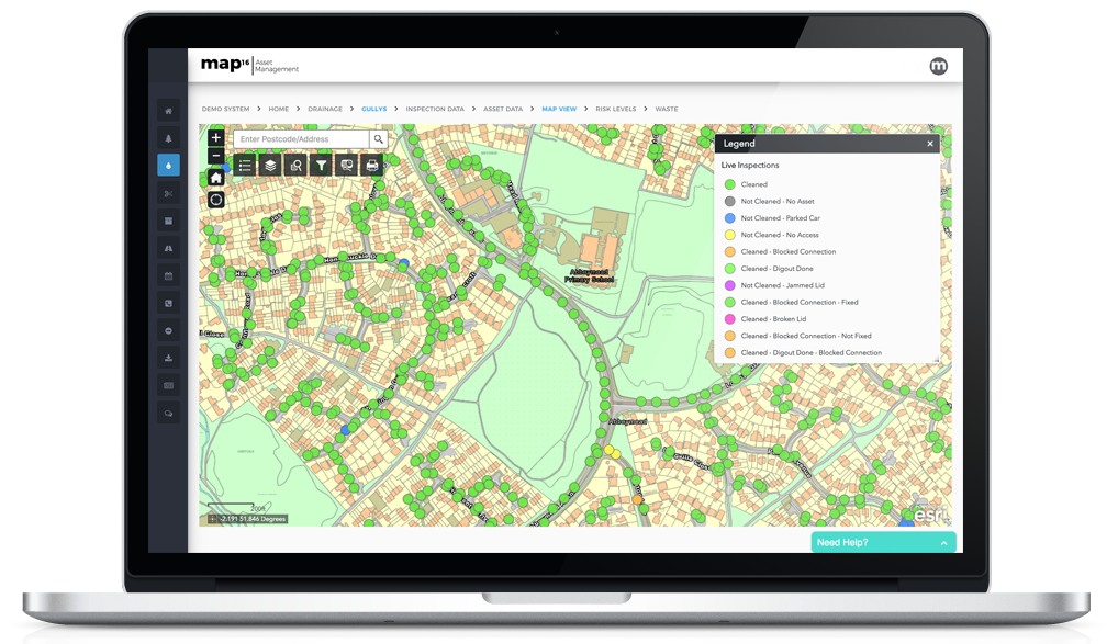
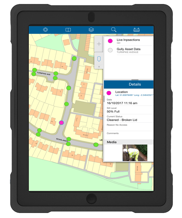
Map Views
With unlimited user access to all our web dashboards, our clients can gain access to key features, live inspection data and historic records. Generate detailed reports to answer queries across your highway network.
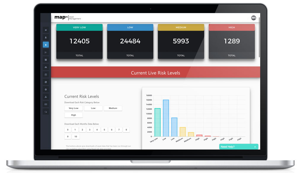
Risk Level Dashboards
In a risk-based maintenance regime, geospatial information can be used to create a targeted and more cost-effective approach. In other words taking analysis of simple historic data to flood zoning, population density, slope data, tree fall and insurance claims, we can create a detailed risk model of your asset datasets. Feed live inspection data into the risk model to give constant risk analysis of the network.