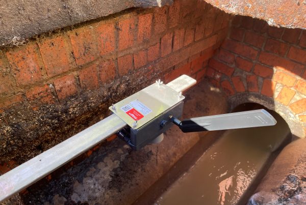
It is crucial to monitor levels to mitigate flood risk. Especially considering the increasing impact of climate change. map16 Gully Sensor measures water levels and automatically provides cleansing schedules, threshold alerts, and prediction of asset behaviour in response to rain events.
Features and Benefits
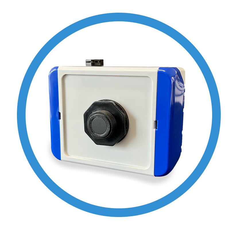
The map16 gully sensor has been designed in-house to utilise the latest cellular technology. The custom-designed electronics allow us to maximise battery life, signal strength and reliability.
- In-house designed technology
- Focused on cost reductions
- Measure water Level
- Measures if the gully is opened
- Measures if the gully grate is covered
- 5+ Years of battery life
- No maintenance is required
- No need to remove the sensor when the gully is cleansed
- Ruggedised design built to withstand the cleansing
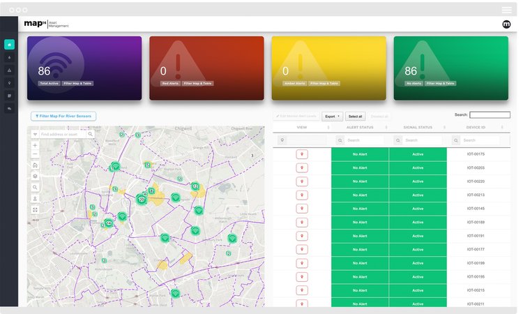
View all sensors and analyse sensor locations through interactive filters and map views. Simple easy to navigate and designed from a users perspective.
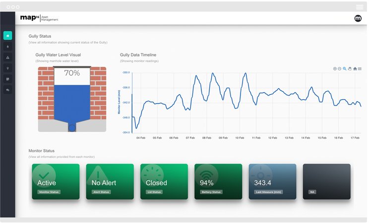
View live gully levels in a clear timeline format. See changes over time in exactly how your gullies are behaving.
- View % Full
- Lid Status
- Is gully covered?
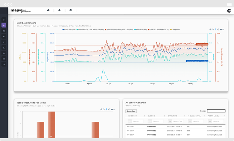
- Pre-warning notifications
- Worst case scenarios
- Best case scenarios
Over time use our predictive analytics to predict how your gully network will react to incoming weather events. Turn to a proactive approach to managing your gully network.
Technical Specifications
Changing perceptions of what’s possible
map16 is focussed on providing a low cost, extensive gully sensor solution that can be installed in large quantities across county wide areas. Designing and manufacturing every aspect in-house allows us to be agile, enabling a quick response to large scale customer requirements.
Without a dense deployment of sensors, it’s difficult to draw conclusions about the state of a network and how it reacts to weather events. Only by creating a completely connected drainage network can you get new insights and take optimised cleansing to the next level.
Case Studies
See how our clients are using map16 to bring optimisations and efficiencies. Find out what we are providing and how this could be used within your organisation.
Merton Borough Council
Already users of the map16 system, Merton Borough Council needed a more efficient way to manage their 6000 priority drainage assets.
They needed an innovative, proactive maintenance solution to allow them to manage high risk areas as a priority, as a huge amount of financial and human resource was being used to process this.
Transport for London
Transport for London noticed a number of subways were flooding due to blocked and overflowing drains, and because of this, pedestrians, including school children, were avoiding walking through the subway, and instead took a busy main road route. FM Conway approached map16 for an IoT based solution to this problem.
Our Happy Clients
See how our diverse range of clients that have adopted the map16 system as an integral part of their asset management solutions.
Get In TouchSee Our Latest News
Keep up to date with our latest news. See all the stories in our news feed below, or check out the latest new page.
Explore