Change the way you manage your safety barriers. Create 100% electronic information. We design bespoke inspection records with the ability to attach images or videos. Our user-friendly mobile collection interface allows teams to work with or without phone signal. Become more efficient using map16.
Vehicle Restraint System
Maintenance
Mapping & Inspections
VRS Management Made Easy
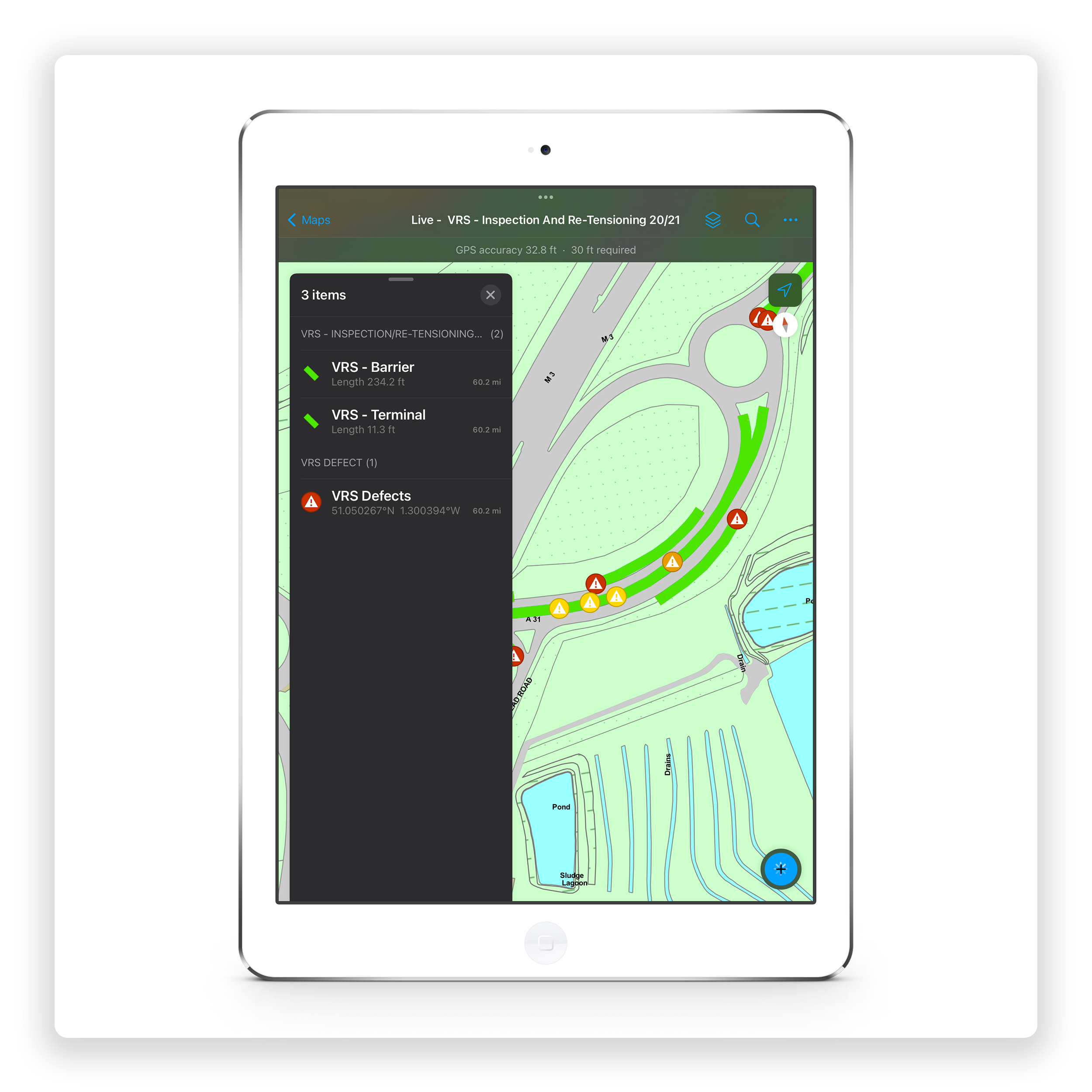
Access live mapping and inspection data for all VRS works. Collect an accurate and up-to-date barrier inventory, with a simple, easy to use mobile collection solution. Remove all manual processing. View all barrier data in a clear visual dashboard and query all data through an easy to use map view.
Mobile Collection
Stop the need for paper records. 100% electronic data.
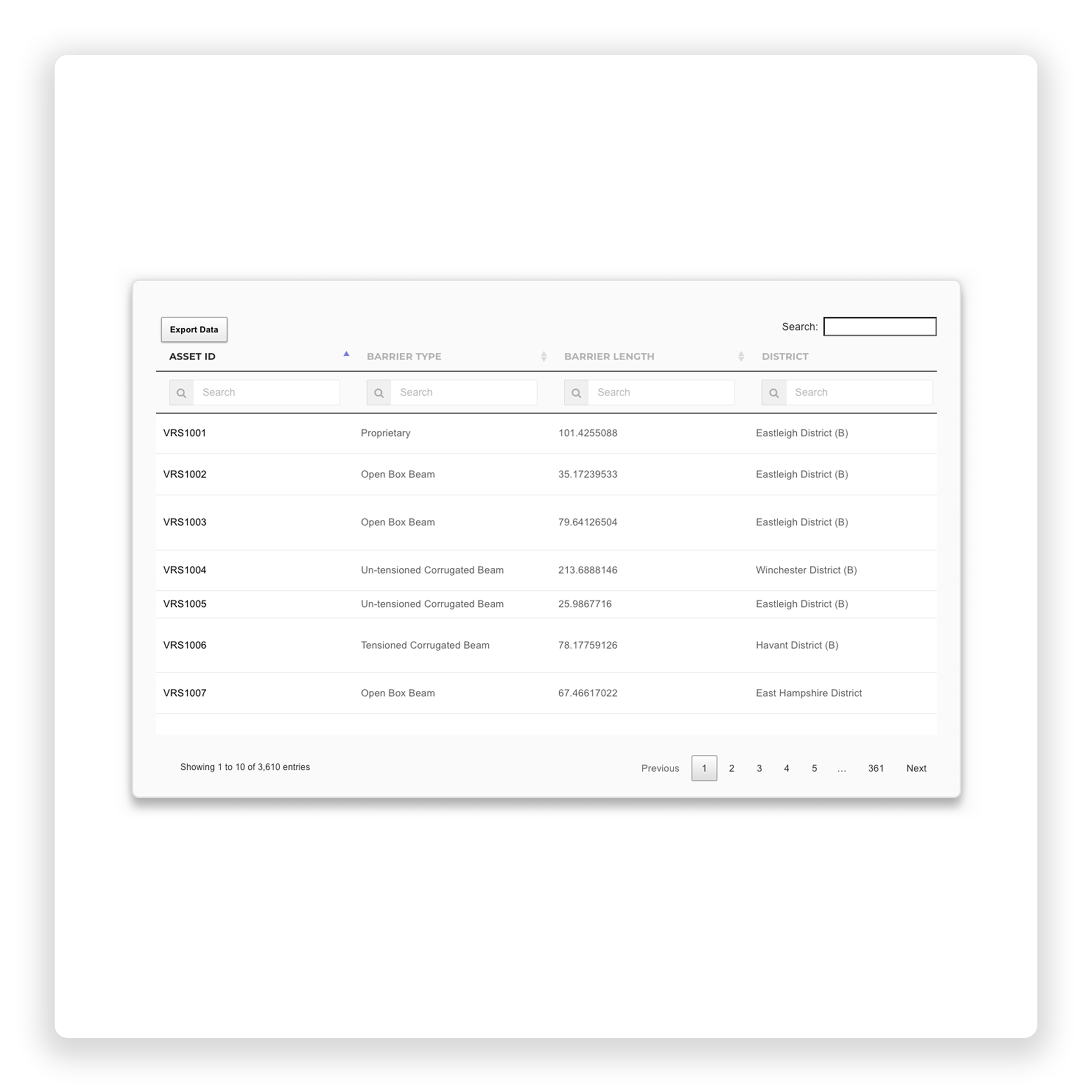
Barrier Mapping
Electronically map every barrier accurately and efficiently.
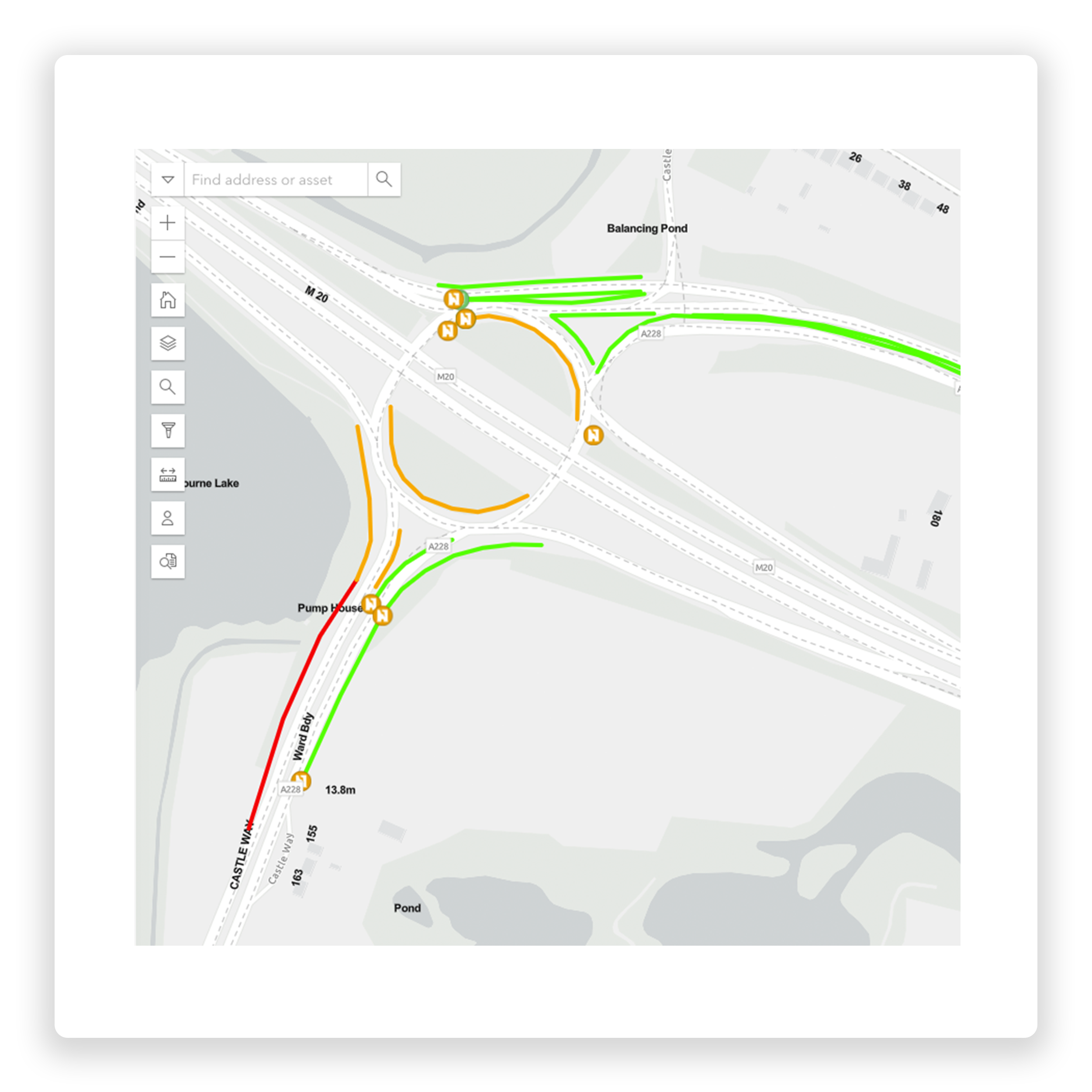
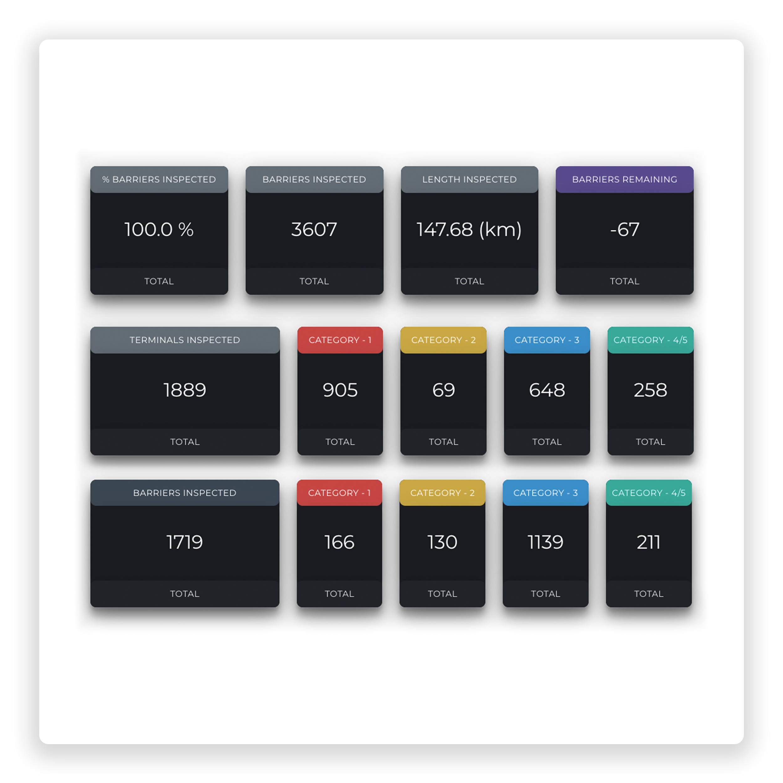
map16 provides bespoke web dashboards designed around VRS requirements. This includes inspection, re-tensioning and defect monitoring. Transform the way you collect and manage your safety barriers data. View live data from teams in the field, monitoring contractual completions as you go.
Web Dashboard
Monitor works live from the field. Map and data views.
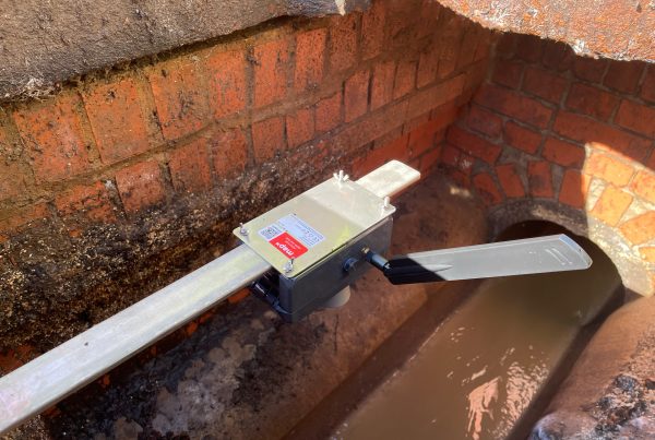
Accurately map every safety barrier across your network. Collet asset information against the industry standard requirements. Automated start and finish co-ordinates as standard. The ability to collect approach sections, barrier sections and departure sections creates a clear view of your network. Add images and specific point defect locations.
Inspection & Re-Tensioning
Collect data for all requirements. Inspections & re-tensioning.
Why not use a system that lets you collect every requirement. Mapping, inspections and re-tensioning. Create inspection records against terminals and barriers. Map accurate defects locations along each barrier. Re-tensioning can be made simple by focusing on temperature with automated torque values, percentage complete and any defects found.
Accident Damage Mapping
Ensure your network is as safe as can be.
Ensure your traffic network is as safe as it can be with accurate accident damage mapping. See exactly where repairs are needed and view detailed defect reports.
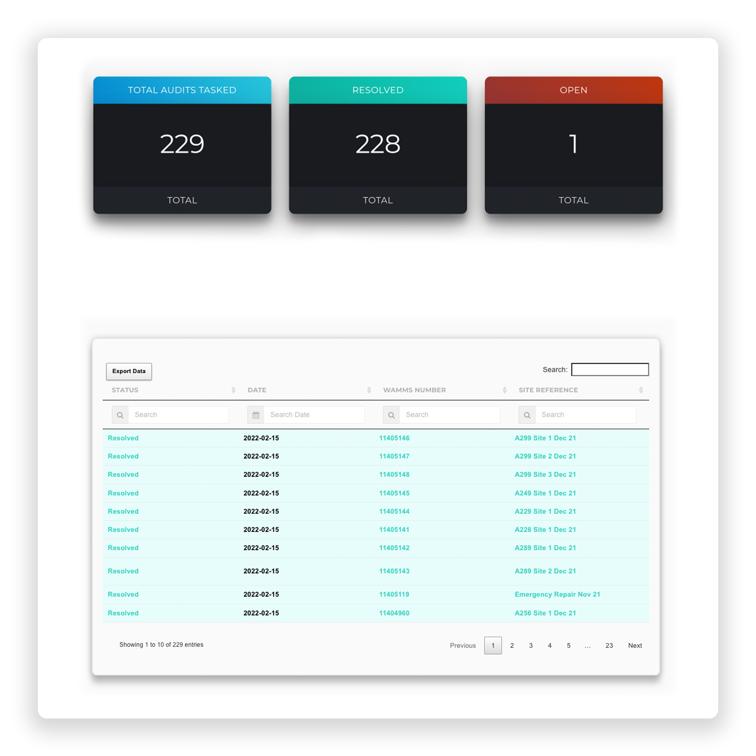
Repair Audits
Increase efficiencies through automated processes.
map16’s whole ethos is to automate processes that will increase efficiencies for our clients. Every aspect of our safety barrier module can be automated. This includes start and finish coordinates, combined with auto creation of inspection and re-tensioning records. Once data has been inputed on the tablets, map16 does the rest. PDF reports can automatically be generated and emailed to interested parties.
Kent County Council
Case study
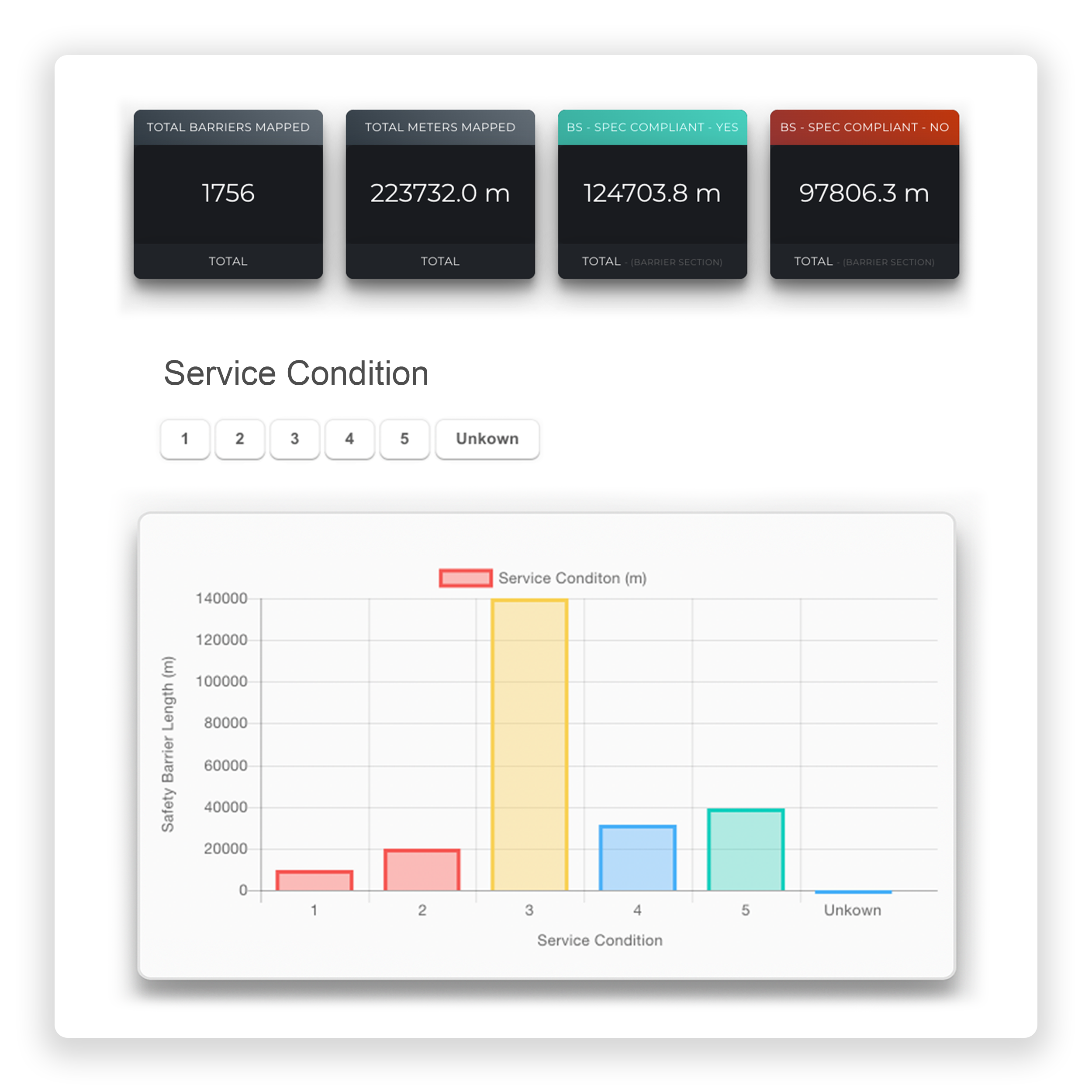
As part of Kent’s 8,700km of highway network, approximately 223 km of vehicle restraint systems are maintained to ensure public safety while on the roads. Inevitably, barriers get damaged due to road traffic accidents, which Kent County Council must repair. Kent County Council and Amey approached map16 for an innovative VRS mapping solution.
The Approach
Using map16 tablets, Kent County Council digitally mapped their entire highway network and logged all associated assets. Any defects and areas of VRS that were found to be damaged were recorded within the system, and interpreted into the asset map. These areas were then addressed and repaired by the council accordingly, and then audited to ensure repairs were accurate.
The Benefits
Properly maintained vehicle restraint systems are paramount for the safety of drivers using high speed roads. During the inspection process, a total of 542 defects were found and logged, full record sets are loaded to the system. Barrier type, service condition and spec compliancy data can also be easily found within the system and can be exported with the click of a button.

600,000
Meters Mapped
500,000
Meters Inspected
260,000
Meters Re-Tensioned
Our Happy Clients
See how our diverse range of clients that have adopted the map16 system as an integral part of their asset management solutions.
Get In Touch
See Our Latest News
Keep up to date with our latest news. See all the stories in our news feed below, or check out the latest new page.
Explore