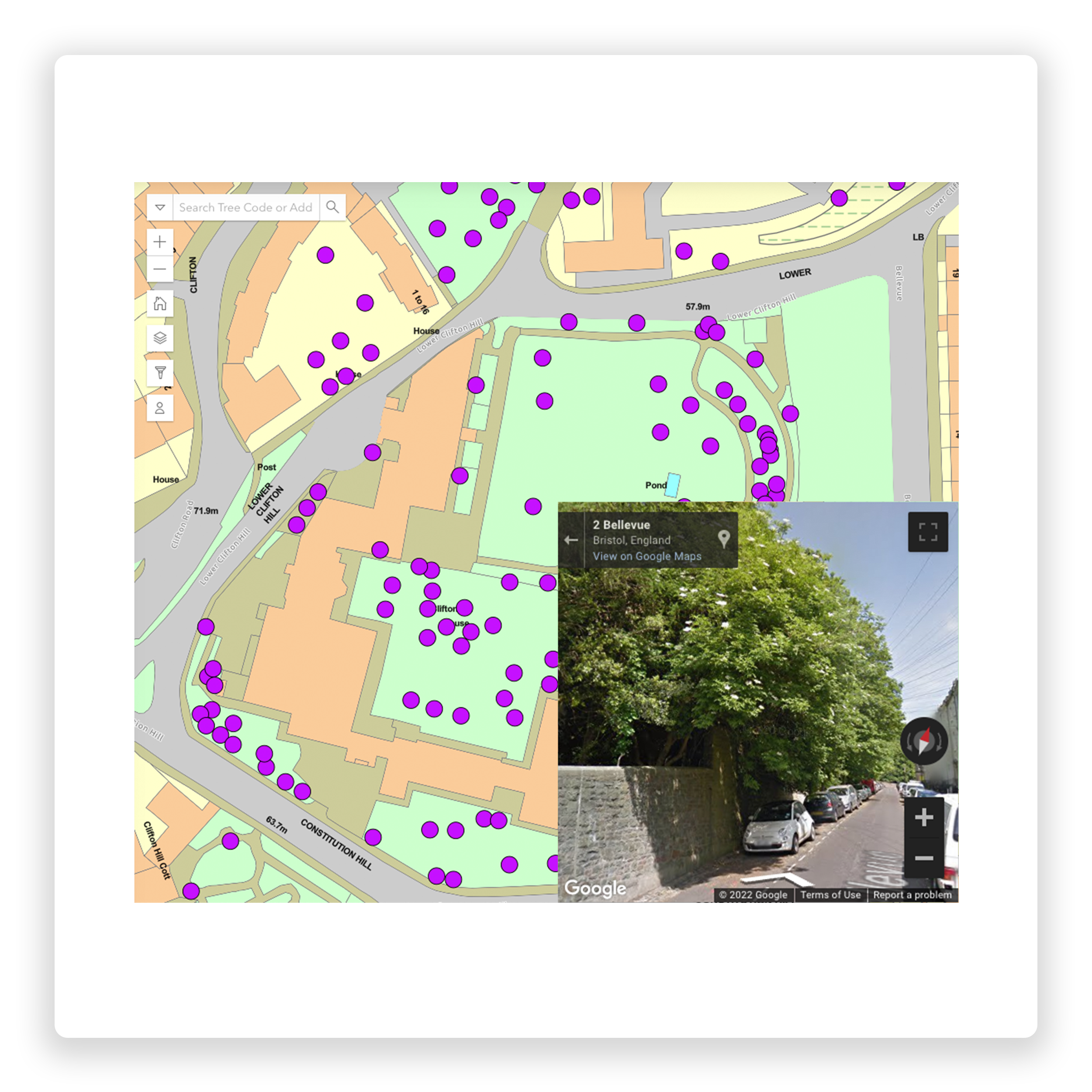
To meet the BS5837 specification, visualise the crown spread taken at four cardinal points, showing the overall extent of tree canopies. This is available for individual trees, woodlands or substantial tree groups. Root protection areas can also be visualised within the mapping interface.
Tree Management
Mapping, Inspections Solutions
Custom Designed Tree
Management Solutions
As part of our standard service, map16 can design a tree management solution that is tailored around every client. Why settle for an off the shelf system, when we can design your own. All of this bespoke design comes as standard and no extra setup costs. We offer a complete tree management solution for the arboriculture industry. Collect new tree assets, create bespoke inspection records. Utilising our mobile solution connected to a live reporting dashboard.
BS5837 Compliant
Use a system that meets the BS5837 specification.
Mobile Collection
Increase survey efficiencies.
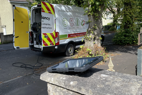
Collect, visualise and report. Our mobile app provides easy functionality with increased user productivity, whilst still capturing all necessary key tree data. Work offline anywhere and sync data when available. Map new tree assets, collect inspections and any works carried out. Use the data intelligently to take care of your tree management regimes.
Web Dashboard
Live dashboard reporting.
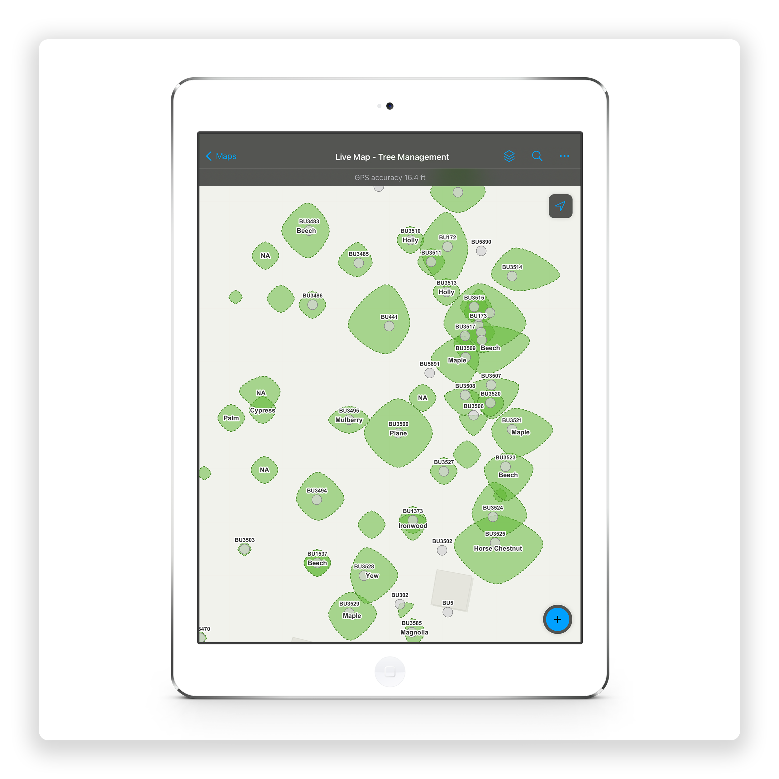
Our arboricultural dashboard brings asset and inspection data together in a map based view, which provides decision makers with all the facts in one place. Smart visualisation based on maturity, height, canopy size, condition and environmental variables giving a broader perspective when making key decisions. Create custom reports on specific assets or inspections, avoiding confusion and saving time. Focus on key areas and utilise map16 reporting tools to do the work for you.
”map16 has become intrinsic to our tree management system, allowing our trees to be mapped and for our inspections to be carried out and logged in real time on an iPad. The completed inspection and subsequent completed works are coloured coded on the map to give a clear visual picture of working progress. The process is slick and efficient and allows for spreadsheets to be downloaded back at the office to compile work schedules, as well as allowing historic data of previous inspections and works, to be compiled.
Kevin StuckeyUniversity of Bristol
University of Bristol
Case study
The Approach
Using map16 tablets, the University of Bristol identified around 5,000 trees within and around their grounds and the surrounding area, and logged these into the map16 system. This allows surveyors to monitor these trees as regularly as necessary, and accurately log the findings directly into a fully integrated map view dashboard, live from the field. Inspection information and specifications such as the tree type, height, maturity, stem condition and basal structure are all displayed in an easy to navigate dashboard, allowing effortless observation and comparison of every tree.
The Benefits
Regular surveying of trees, especially within built up urban areas is crucial for ensuring public and traffic safety, as broken and fallen trees can be a dangerous hazard if not dealt with. By being increasingly aware of their trees condition, the University of Bristol can be one step ahead of their maintenance and management programs, greatly increasing workforce efficiencies. Live and historic data can be downloaded directly into the back-office systems.

4780
Trees Mapped
2300
Trees Inspections
Our Happy Clients
See how our diverse range of clients that have adopted the map16 system as an integral part of their asset management solutions.
Get In Touch
See Our Latest News
Keep up to date with our latest news. See all the stories in our news feed below, or check out the latest new page.
Explore