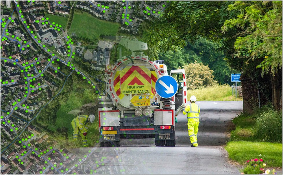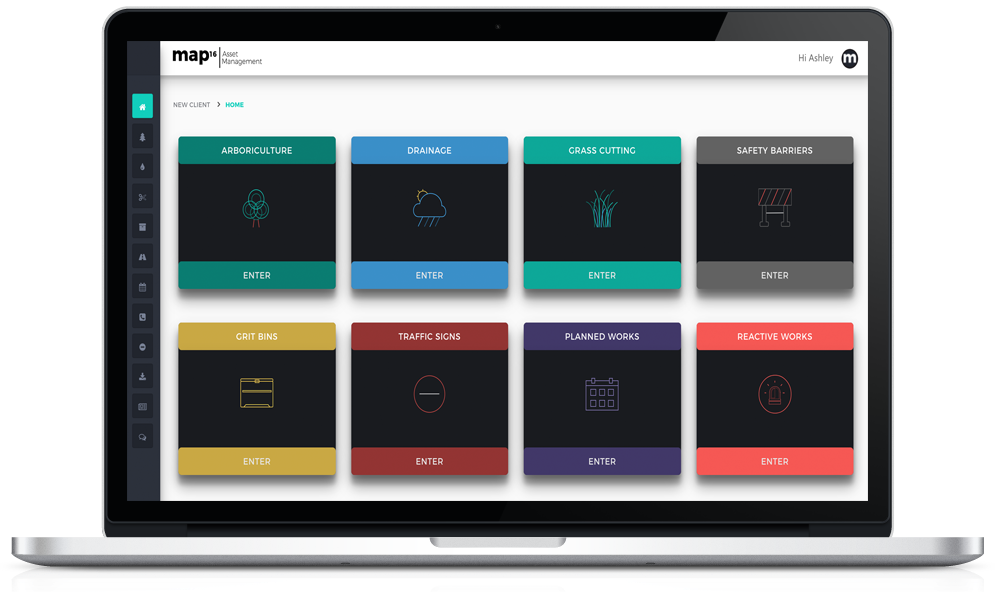
Here at map16 we wanted a gully management system that would give our clients more than ever before. Not just access to live data, but a system where that data has been visualised and made easily accessible for the every day user. All the day to day analysis and tabulation has already been done for you, just export it.
A gully management system that saves time throughout the day and never becomes an onerous chore to use.
The key features of our gully management system are outline below;
Mobile Collection
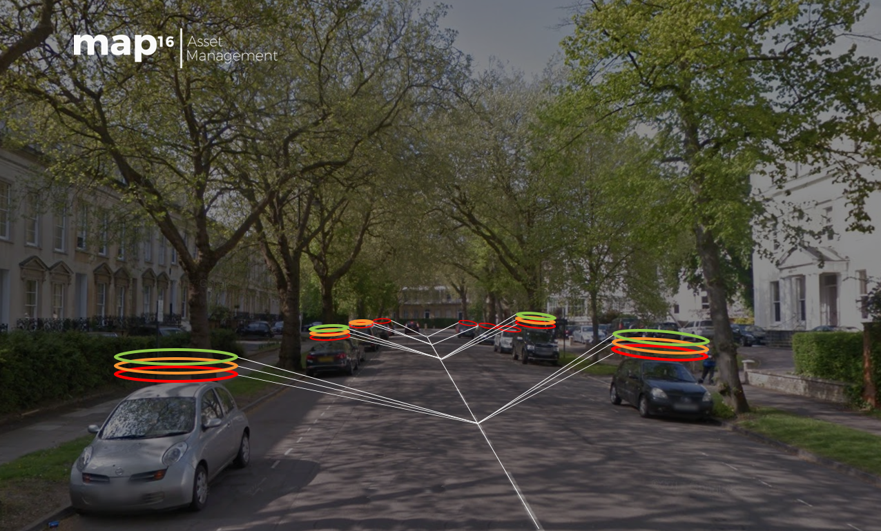
Our innovative new way of collecting data, allows a one time setup, enabling constant working, without the need for creating separate work packages. Set custom map visualisations, such as parked car revisits to enable teams to get key information live in the field. Powered by the world leader in GIS technology, Esri.
map16 provides a mobile solution designed to increase efficiency and reduce cost. Collect new assets and live inspections. Use iOS or Android.

-
- End Of Back Room Processing
-
- End Of Work Packages
-
- One Time Setup
-
- Work Offline
-
- Automated Revisit Maps
- OS Mastermap As Standard
Inspection Dashboards
Designed to give operational staff access to live reports, that have been created to reduce wasted time and increase efficiency. Change the way you work, let map16 dashboards do the work for you.
An inspection dashboard we always wanted
-
- KPI Reporting
-
- Crew Productivity Reports
-
- Defect & Silt Level Reporting
-
- Road By Road Reporting

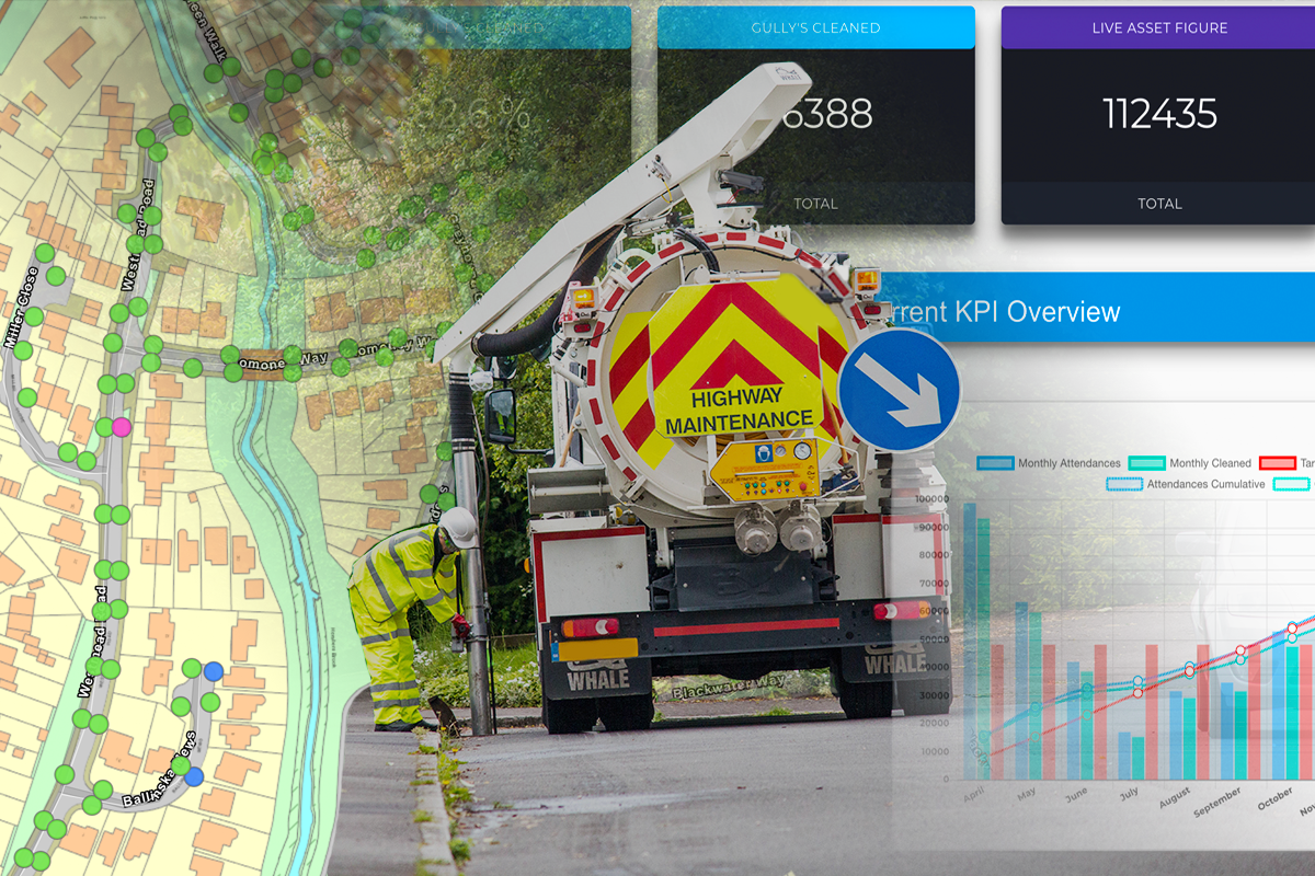
Asset Dashboard
Use a system that will manage and visualise your asset data for you
-
- Visual Overview Of Asset Figures
-
- Detailed Asset Reporting
-
- Parish By Parish Reporting (Or Any Other Geospatial Boundary)
-
- Live Inventory Creation

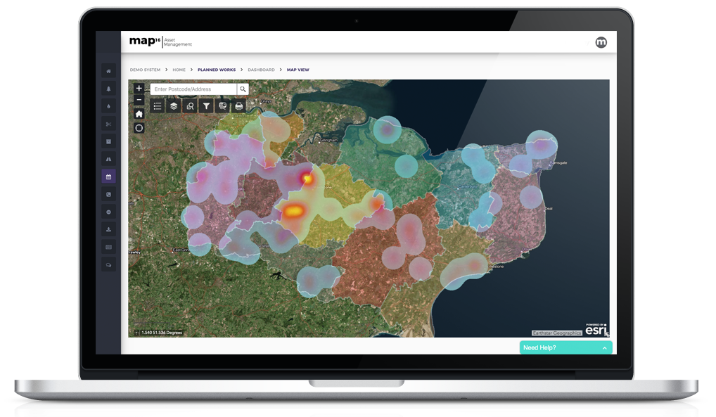
Map Views
A mapping interface that gives you access to live inspection data, historic data and detailed reporting tools. Designed for all assets and work streams. Increase user interaction with unlimited user access and the simplicity of the workflow. Generate detailed reports to answer queries across your highway network.
A mapping interface design for users by users
-
- Live mapping interface
-
- Query & Filter Live Data
-
- View Live & Historic Inspections
-
- Create Detailed Reports
-
- Street View Integration
- Answer Public Queries In Seconds

Risk Level Dashboards
As a standard map16 provides a risk analysis of your highway assets. Increase efficiency by adopting a risk based approach. Use map16 risk dashboards to visualise risk levels anywhere on your highway network
Make operational decisions based on risk
- Visual Overview Of Risk Data
- Easy Export Of Key Data
- Live Road By Road Risk Updates
- Risk Level MapView

To find out more about our drainage solutions, click on the link below.